
 Dyrestuy
Mikhaylovka
Mayskiy
Novobessergenevka
Tersky District
Lesnoy
Tertezh
Kuz'minskiye Otverzhki
Meshcheryaki
Dyrestuy
Mikhaylovka
Mayskiy
Novobessergenevka
Tersky District
Lesnoy
Tertezh
Kuz'minskiye Otverzhki
Meshcheryaki
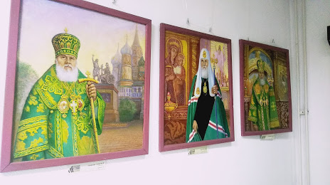
Museum of the History of Orthodoxy in the land of the Kuznetsk auf der karte, Kemerovo, Russland
Foto
Wo befindet sich Museum of the History of Orthodoxy in the land of the Kuznetsk
Museum of the History of Orthodoxy in the land of the Kuznetsk — lokale attraktion, die sich in befindet Ulitsa Sobornaya, 24, корп. 3, Kemerovo, Kemerovo Oblast, 650004 und gehört zur kategorie — museum. Durchschnittliche Besucherbewertung für diesen Ort — 4.2 (entsprechend 26 bewertungen, informationen aus offenen quellen und relevant für 2022).
Genaue Position — Museum of the History of Orthodoxy in the land of the Kuznetsk, auf der karte mit einer roten markierung markiert.
Sie können wegbeschreibung erhalten Museum of the History of Orthodoxy in the land of the Kuznetsk auf der karte von ihrem standort aus.
Was sonst noch interessant ist Kemerovo? Sie können alle Sehenswürdigkeiten sehen, wenn Sie auf die Stadtseite gehen.
Koordinaten
Museum of the History of Orthodoxy in the land of the Kuznetsk, Russland koordinaten im dezimalformat: breite — 55.34047217308497, länge — 86.10073289828107. Bei Umrechnung in Grad, Minuten, Sekunden Museum of the History of Orthodoxy in the land of the Kuznetsk hat die folgenden koordinaten: 55°20′25.7 nördlicher breitengrad und 86°6′2.64 östlicher längengrad.
Städte in der Nähe
Die größten Städte in der Nähe:
- Leninsk-Kusnezki — 76 km
- Tomsk — 144 km
- Sewersk — 157 km
- Prokopjewsk — 167 km
- Nowokusnezk — 188 km
- Nowosibirsk — 202 km
- Meschduretschensk — 225 km
- Barnaul — 267 km
- Atschinsk — 290 km
- Bijsk — 316 km
- Abakan — 394 km
- Krasnojarsk — 429 km
- Rubzowsk — 540 km
- Kansk — 601 km
- Öskemen
 (Kasachstan) — 643 km
 - Semei (Kasachstan) — 681 km
- Kysyl — 701 km
- Pawlodar (Kasachstan) — 702 km
- Nischnewartowsk — 803 km
Entfernung zur Hauptstadt
Entfernung zur Hauptstadt (Moskau) handelt von — 2988 km.