
 Dyrestuy
Mikhaylovka
Mayskiy
Novobessergenevka
Tersky District
Lesnoy
Tertezh
Kuz'minskiye Otverzhki
Meshcheryaki
Dyrestuy
Mikhaylovka
Mayskiy
Novobessergenevka
Tersky District
Lesnoy
Tertezh
Kuz'minskiye Otverzhki
Meshcheryaki
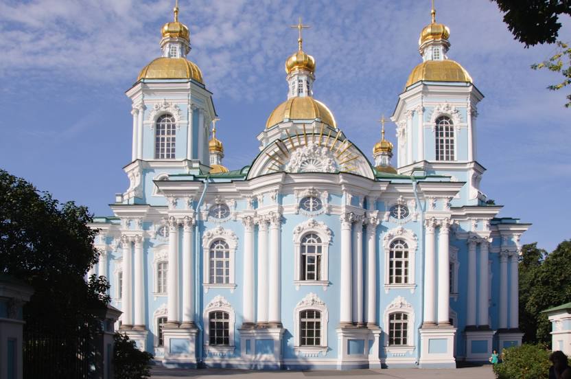
Nikolo-Bogoyavlenskiy Morskoy Sobor auf der karte, Metallostroy, Russland
Foto
Wo befindet sich Nikolo-Bogoyavlenskiy Morskoy Sobor
Nikolo-Bogoyavlenskiy Morskoy Sobor — lokale attraktion, die sich in befindet Nikol'skaya Ploshchad', 1/3, St Petersburg, 190068 und gehört zur kategorie — cathedral. Durchschnittliche Besucherbewertung für diesen Ort — 4.8 (entsprechend 3513 bewertungen, informationen aus offenen quellen und relevant für 2022).
Genaue Position — Nikolo-Bogoyavlenskiy Morskoy Sobor, auf der karte mit einer roten markierung markiert.
Sie können wegbeschreibung erhalten Nikolo-Bogoyavlenskiy Morskoy Sobor auf der karte von ihrem standort aus.
Was sonst noch interessant ist Metallostroy? Sie können alle Sehenswürdigkeiten sehen, wenn Sie auf die Stadtseite gehen.
Koordinaten
Nikolo-Bogoyavlenskiy Morskoy Sobor, Russland koordinaten im dezimalformat: breite — 59.9224730969549, länge — 30.299999998462894. Bei Umrechnung in Grad, Minuten, Sekunden Nikolo-Bogoyavlenskiy Morskoy Sobor hat die folgenden koordinaten: 59°55′20.9 nördlicher breitengrad und 30°17′60 östlicher längengrad.
Städte in der Nähe
Die größten Städte in der Nähe:
- Kolpino — 8 km
- Sankt Petersburg — 19 km
- Pleskau — 255 km
- Dorpat
 (Estland) — 272 km
 - Petrosawodsk — 295 km
- Vaanta
 (Finnland) — 307 km
 - Helsinki (Finnland) — 311 km
- Espoo (Finnland) — 327 km
- Tallinn (Estland) — 328 km
- Welikije Luki — 383 km
- Tampere (Finnland) — 404 km
- Tscherepowez — 424 km
- Turku (Finnland) — 457 km
- Twer — 459 km
- Nawapolazk
 (Weißrussland) — 490 km
 - Dünaburg
 (Lettland) — 500 km
 - Riga (Lettland) — 500 km
- Rybinsk — 522 km
- Wologda — 533 km
Entfernung zur Hauptstadt
Entfernung zur Hauptstadt (Moskau) handelt von — 634 km.